


Secure land and property rights are important in addressing poverty because they underpin social inclusion and economic development. In the recent past, many countries have completely restructured their legal and regulatory framework related to land to harmonize statutory laws with customary land tenure systems to improve security of tenure. In many developing countries, rapid and unmanaged urbanization is increasingly putting pressure on available land resulting to an unprecedented demand for land in cities, often leading to uncontrolled and unorganized developments and informal settlements, as people settle on available land, often lacking security of tenure. According to the 2018 revision of World Urbanization Prospects report, 55% of the world’s population lived in urban areas (in 2018) and by 2050, this proportion is projected to increase to 68%, adding another 2.5 billion to cities, where approximately 90% of this population is projected to take place in Asia and Africa (UN DESA, 2018). The number of people living in informal settlements in Africa is likely to increase significantly in the coming decades, as the increasing population outpaces the number of affordable housing to accommodate these people.
Namibia has been working on land reform programs and legislation to address the unequal and skewed distribution of land from the colonial regime. This has been exacerbated by rapid urbanization, increasing the demand for land resources and services in urban areas. The Namibia Housing Survey conducted in 2011 by the Namibia Statistics Agency found that there were 228, 423 shacks in 308 informal settlements in Namibia and that the majority, 83%, were in urban areas. Okahandja in Otjozonjupa region of Namibia, recorded an increase from 18,071 people in 2001 to 24,451 in 2011 and this number is projected to double especially due to Okahandja’s proximity to the capital city which attracts migrants looking to access basic services and better job opportunities. However, the urban job market is often unable to absorb all newcomers and many end up living in informal settlements.
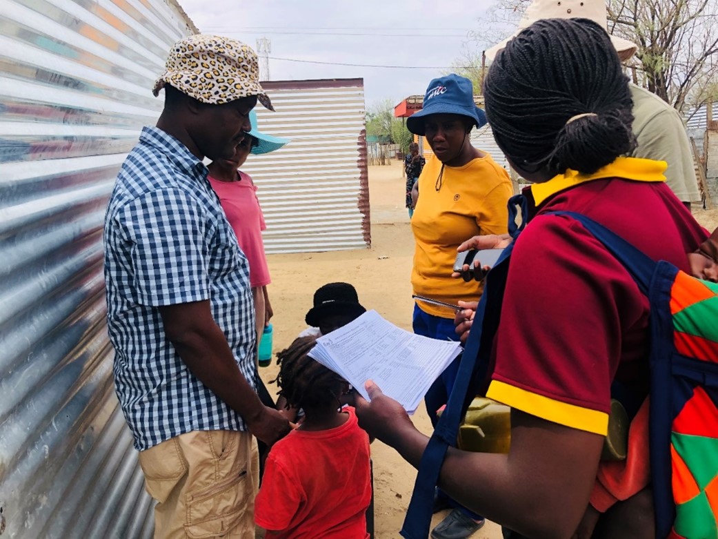
The municipality of Okahandja has been working to register the households and issue certificates of acknowledgement, referred to as “Permission to occupy”- which are licenses allowing the holder to occupy government land and apply for ownership if/when such rights became available. Hence, the municipality engaged students from Namibia University of Science and Technology (NUST) to assist. The local authority lacked the necessary information, i.e., an informal land inventory system about these communities which is necessary to facilitate the issuance of certificates, as well as to guide while updating the records. This is the gap the Social Tenure Doman Model (STDM), a land information system developed by the Global Land Tool Network (GLTN), as facilitated by UN-Habitat is looking to close through the implementation of the “Tenure Security Intervention in Informal Settlements through Tenure Responsive Land Use Planning (TR-LUP) in Namibia” project. Inadequate land records accelerate insecurity of tenure and generate land disputes while making it difficult to manage the available land or set up economic and social services. Tenure responsive land use planning recognizes and respects existing land tenure rights, paving the way for an equitable and sustainable land management.
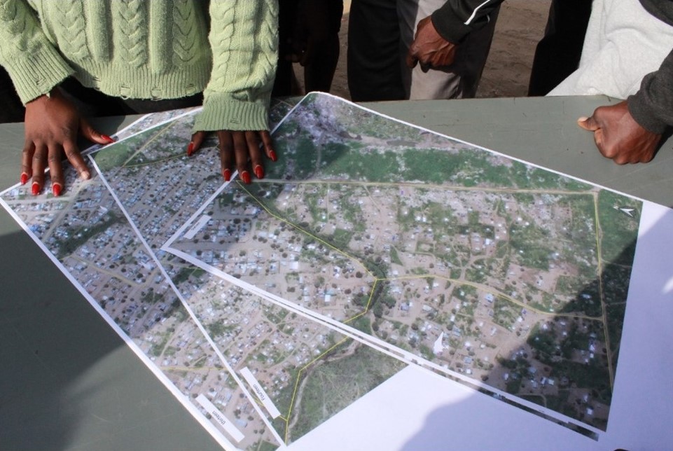
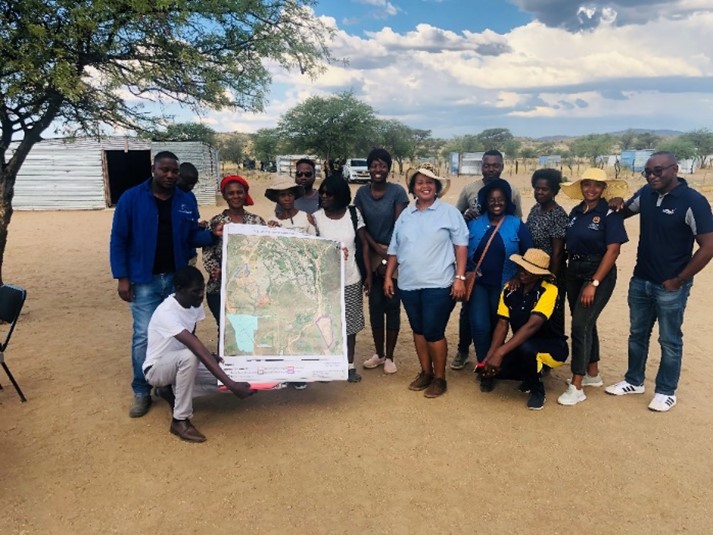
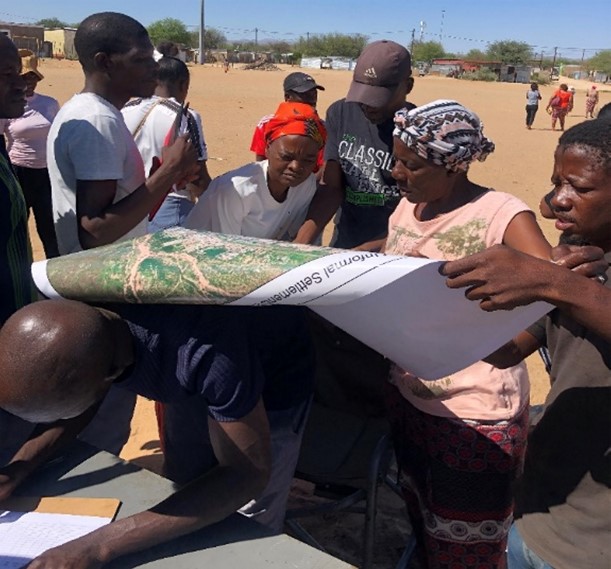
NUST, through the department of Land and Property Sciences is a GLTN partner and a front runner in creating awareness on the STDM in Namibia through staff and student involvement. NUST is collaborating with the Okahandja municipality, and the Namibia Housing Action Group (NHAG), a local organization affiliated to Shack Dwellers International (SDI), working closely with Slum Dwellers Federation of Namibia (SDFN) to conduct profiling, enumeration, and mapping activities in five informal settlements: Ekunde 1, Ekunde 2, Ekunde 3, Ekunde 4 and Vyf- Rand, of Okahandja. The objective of the project is to improve tenure security for informal settlements through participatory planning. The initial phase of the project focused on informal settlement profiling, enumeration, introduction of the STDM, software installation and training community members and the local authority representatives. Throughout the project, research on tenure responsive land use planning and the interoperability of PenMap and STDM was done. The community was then engaged in planning studios, through block-by-block meetings, where they expressed concerns about the settlement’s status and participated in discussions regarding a proposed layout. The local authority officials and the project team underwent training on the STDM theory and its accompanying software to enable them effectively to utilize the STDM software for capturing and updating community information.
It is worth noting that the communities are actively involved in the planning of their settlements including data collection, mapping and enumeration and designing of the envisioned layout of their settlements. The draft layout will be submitted to the municipality of Okahandja for review and approval. Further, the block-by-block meetings are ongoing, through a created WhatsApp Group, to increase participation and understanding of the land tenure options while providing updates and requests on project implementation progress. The project in Okahandja has made significant progress in improving an understanding of the importance of tenure security in informal settlements and promoting participatory planning through the use of the STDM to document, map, and engage community members in the design of their settlements. These efforts shall lay the groundwork for more equitable and sustainable land management practices in Okahandja and guide discussions by the municipality’s town planning consultants on city-wide planning.