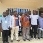
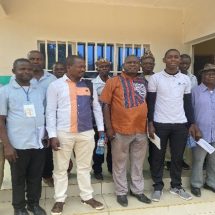
GLTN and UN-Habitat in collaboration with International Fund for Agricultural Development (IFAD), the Smallholder Dairy Commercialization Programme (SDCP) and the Resource Conflict Institute (RECONCILE) successfully launched the SDCP Land Information Management System Center and Database on the 25th January 2018.
The launch event brought together 23 participants from the Bomet County land, agriculture, fisheries, forestry and livestock departments, the Agricultural Sector Development Support Programme, SDCP (PCU and Bomet) staff from the National Ministry of Agriculture, Livestock and Fisheries, members of the Provincial Administration, National Environment Management Authority (NEMA) officials, Pamoja Trust and RECONCILE.
Hosted by the SDCP Bomet project office, the launch was officiated by the Chief Officer for Agriculture, Livestock Development and Fisheries in Bomet County, Dr. Alexander Chirchir. “We acknowledge the application of STDM has supported in identification of abandoned and encroached resources and thus we are able to see them in these maps. This should support the county in making great strides in mapping all shared natural resource and encourage more investments to take care of the resources within our county,” noted Dr. Chirchir. ‘The model has the capacity to transform Kenya’s agricultural sector into an innovative, commercially oriented, competitive and modern industry that will contribute to poverty reduction, improved food security and equity in rural Kenya.”

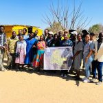
The STDM-based database provides comprehensive socio-economic and spatial data on land and natural resources within three sub counties in Bomet. The data was generated through participatory enumerations and geospatial mapping within Dairy Centralization Areas 1, 2 and 3, and captured 52 communal resources Bomet East, 43 communal resources in Chepalungu, and 12 communal resources in Bomet Central (including cattle access corridors, communal grazing lands, salt licks, water points, cattle dips etc) sub counties respectively. In addition, total of 1020 households, the corresponding dairy animals per household and private resources have been geo-referenced for all SDCP dairy farmers from the three sub-counties.
‘Through the Scaling Up Participatory Enumeration and Mapping using STDM in Securing Grazing Land Rights project in Bomet county, poor communities have strengthened tenure on land natural resources, which they depend on for their livelihoods through pro-poor and gender responsive land records’ documentation using STDM’ noted the SDCP Bomet Project Coordinator Mr. Evans Kiplagat.
‘As much as this launch marks completion of enumeration of the SDCP affiliated smallholder dairy farmers in Bomet, this is the start of an operational process to reclaim and revitalize lost communal assets which we will advocate to be scaled county wide,’ he stated.

Efforts to expand the STDM-based land and natural resources’ information database of all the Dairy Commercialization Areas (DCA) 1, 2 and 3 in SDCP are in progress. The goal is to make the database operational, therefore easing the location of resources, and their participatory, sustainable management by the communities. The database will also be useful in producing an inventory that will track the available resources versus the animal population, thus informing the carrying capacity of the land and stocking rates for Bomet County.
This intervention was implemented under the Land and Natural Resources Tenure Security Learning Initiative for East and Southern Africa (TSLI-ESA). This is a regional project jointly implemented by GLTN and IFAD as a key intervention to strengthen efforts on identifying and addressing land and natural resources tenure security issues in IFAD-supported projects in selected countries in Eastern and Southern Africa (ESA). By integrating pro-poor and gender-responsive land documentation tools, TSLI-ESA strengthens the rights of poor communities to land and natural resources, and the revenue streams linked to those rights.

Submitted by/Photos: Brendah Achungo

