

The Democratic Republic of the Congo
Country Information
With a surface area of 2 345 410 square kilometers and a population of approximately 89 million (of which nearly 70% live in rural areas), the Democratic Republic of the Congo (DRC) is endowed with about 135 million hectares of agricultural land, that is neither forest nor montane land, and which represent about 34% of the national territory. Of this, only 10% is developed. Despite the fact that the law vests the management of land in the state (the government), both urban and rural land, a large portion of these lands continue to be governed by customary law and practices through which traditional chiefs claim a historical and social right to management.
The absence of an adapted land policy adapted to the new strategic directions of sustainable development (Millennium Development Goals) and to the developments recorded by the country on the political, economic, social, cultural and environmental level is pointed out as one of the major causes deficits that we deplore today. It has resulted in the emergence of a system and practices that do not promote land productivity. In this context, rather than being an instrument of social pacification and one of the supports of economic development, this system polluted by corruption and the ineffectiveness of the Land Administration has led to mixed results, which have been reflected in particular by the insecurity of land tenure in rural and peri-urban areas, the predominance of practices on the fringes of the law in urban areas, the proliferation of land disputes, land speculation, insufficient valuation of land resources and of their products, etc.
These practices bring out the weak capacity of land departments of the government including:
- Weak management of the sector.
- Lack of an adequate system of land information management and maintenance of records.
- Lack of transparency in land transactions.
- Conflicts between the land administration departments and traditional authorities.
- Lack of a harmonization/cooperation of the institutional framework.
Taking into account the socio-economic developments in the country and new directions suggested by the modernizing vision of the Congolese government, several factors justify the launching of a debate around land governance in DR Congo: legal, political, economic, and socio-cultural.
UN-Habitat with the technical support of GLTN has been operating in the DRC since 1998. During this period, a wide range of projects and programs with real impact on the lives of the populations have been developed:
- The National Survey on Housing and Socio-economic Profile of households in urban areas/ RDC 1999 survey, with funding from the UNDP;
- The study of the National Action Plan for Housing along with a priority investment program, approved by the Government of the DRC in 2002, with funding from the UNDP;
- The Urban Plan of the Lac Vert / Mugunga site, east of the city of Goma in 2002-2003 after the Nyiragongo volcanic eruption, with funding from the UNDP;
- The Community Participatory Program in 2006-2007 in the municipalities of Ndjili and Masina in Kinshasa with funding from the Spanish cooperation.
- The Urban Development Plan of the City of Kisangani, in 2009 – 2010 with funding from the UNDP;
- The Participatory Slum Improvement Program, first and second phases in Bunia, Kisangani, Lubumbashi and Kinshasa, since 2004 with funding from the European Union.
Later on, UN-Habitat implemented the following projects and programs:
- Community Participatory Land Planning
- Project “Amani ni njia ya Maendeleo”: “Peace is the way of Development” (IRF Mambasa) – Phase 2
- Integrated North Kalehe stabilization project in South Kivu. Phase 2
- PAMOJA KWA AMANI
- Land governance, social cohesion, socio-economic reintegration and prevention of Gender-based Violence in Kitshanga.
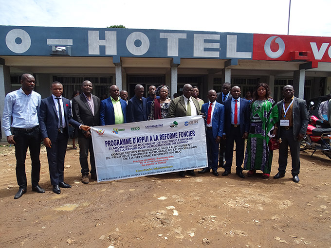
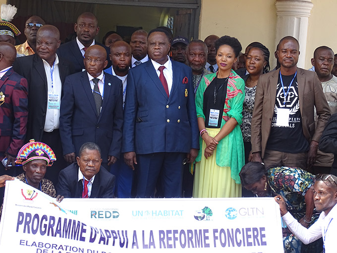
- Support to DRC land reform program: Elaboration of the land policy document in the DRC
These programmes have finished except the Support to DRC Land Reform Programme which is still under implementation. Resource mobilization for new interventions is done at local, national and international levels to ensure the continuity of UN-HABITAT/GLTN programs in the country.
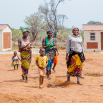
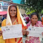
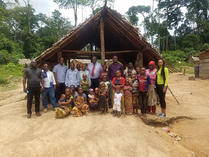
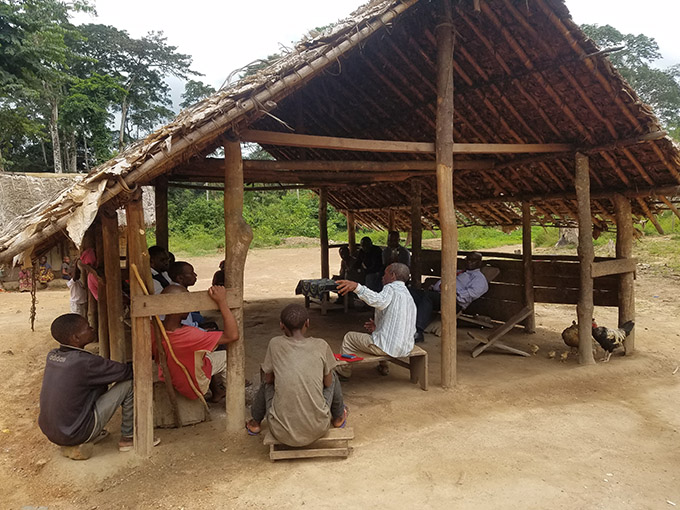
Photo Gallery

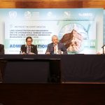
Land Reform Programme
Implemented with the support of UN-Habitat / GLTN, in collaboration with the National Ministry of Land Affairs through the National Commission of Land Reform ‘CONAREF: Commission Nationale de la Reforme Foncière’, the land reform Support Program is registered in the National REDD + Strategy and its Investment Plan. This Program, as approved, aims to improve the land management to avoid conflicts, contribute to the permanence of realized emissions reductions and improve the attractiveness of REDD +investments, for effective and efficient implementation of REDD + in the DRC.
The Land Reform Support Program comprises three main work axes, reflecting its specific objectives, namely:
- the strengthening of the National Land Reform Commission or ‘Commission Nationale de Reforme Foncière’ (CONAREF) so that it can be able to take over and implement the land reform,
- participatory formulation of a national land policy document and legal texts and related regulatory requirements
- the development of methodological guides for strengthening the ‘Cadastres’ and capitalize lessons learnt from pilot experiences (December 2018).
Current status of the programme as for January 2020:
- CONAREF is functional and conducting its statutory meetings at a regular basis. The Administration and Finance manual of procedures has been validated and is in use. Capacity building for staffs has been launched.
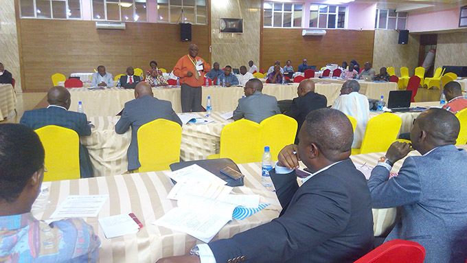
- The first draft of the Land Policy document is available and undergoing provincial consultations in order to make the land reform a participative process and collect land stakeholders’ inputs on the draft Land policy document.
- The land information system (LIS) is under experimentation through Community Land Register as part of LIS at community level. The methodological guides as tool for support to communities have been drafted.
Key documents
- Country Brief
- GLTN – DRC Plan of Action
- Improving women’s access to land in Eastern DRC: Challenges and emerging opportunities
- Guide to Land Mediation
- Guide de mediation fonciere: Base sur l’Experience de l’Est de la Republique Democratique du Congo
- Atelier de Consultation des Partenaires sur le Developpement du Plan D’amenagement Foncier Participatif (PAFP)
- Article: Developing the land policy document and strengthening the capacity of the land administration in the DRC-2019 Highlights
Kenya
Securing land tenure and property rights are fundamental for the realisation of human rights, poverty reduction, food security, sustainable urban development, economic prosperity and environmental sustainability; it is highly critical for the developing countries’ quest for socio-economic development. This situation prevails in Kenya where questions concerning land tenure, property rights and land administration command pivotal positions in the social, economic, legal and political fabric as stated in key policy documents such as the Constitution of Kenya, the National Land Policy and Vision 2030.
The land issues in Kenya are highly contentious and emotive highlighting the complexities resulting from the colonial era. During the colonial era large tracts of land were taken from Kenyans and given for European settlements and farming – the local were evicted from the land through the enforcement of European law. After independence in 1963 the Government acquired farms from European Settlers and distributed them to landless Kenyans; however, the Kenyan elites obtained much of the land of departing settlers.
The importance of addressing land issues in Kenya is reflected by the dedication of Chapter Five of the Constitution to Land and Environment which signifies the resolve to address the “Land Question”. Some scholars attribute the Land Question as a source of conflict: The main legislative frameworks governing land in the country are:
- The Constitution of Kenya (2010) & the National Land Policy designate land is Kenya as public land, community land and private land.
- Others: Land Act 2012, the Land Registration Act 2012, National Land Commission Act 2012, the Environment and Land Court Act 2011: the Community Land Act 2016 and Draft Evictions and the Resettlement Procedures Bill (2012)
At the institutional level, the main bodies governing land are the Ministry of Lands and Physical Planning and the National Land Commission (NLC) at the national level and County Land Management Boards at the county level.
In Kenya, UN-Habitat/GLTN has been supporting Kenya’s Land Reform Programme and Land Policy Implementation since 2003; this has informed some of the Land Tools that are currently being shared with other countries where relevant. The continuing GLTN engagement strategy for Kenya has its origins in the successes, lessons and goodwill attained through country-level engagement while at the same time assimilating the agreed global and regional frameworks on land such as the Voluntary Guidelines on the Responsible Governance of Tenure of Land, Fisheries and Forests (VGGTs); Framework and Guidelines on Land Policy in Africa (F&G) and other relevant guiding principles.
The main objective of GLTN interventions in Kenya is to contribute to improving tenure security and living conditions of poor urban communities in select areas and to increase knowledge and understanding on land governance and the need for pro-poor and fit-for-purpose land administration solutions in IFAD-supported projects. The key strategies are supporting existing partners’ initiatives, increasing the knowledge and awareness of change agents and strengthening the capacity of partners and communities to implement pro-poor and gender responsive land tools and approaches.
Key documents
Namibia
The overall rationale of GLTN’s engagement in Namibia is to support partners in Namibia in efforts to improve security of tenure of Namibians, with particular focus on poor and marginalised communities. This has involved supporting the establishment and implementation of Namibia’s Flexible Land Tenure System (FLTS); as well as technical support and the provision of innovative pro-poor and gender responsive land tools, in particular Participatory Enumeration and the Social Tenure Domain Model. To date the main emphasis has been on city and small town informal settlements, as the relevant legislation, the Flexible Land Tenure Act (FLTA) does not in its current form pertain to rural areas. Through UN-Habitat, GLTN has been involved in the drafting of Regulations for the FLTA, as well as a process of clarifying the FLTA process with the stakeholders and laying the foundation for piloting, in particular in Gobabis Municipality.
The fact that various GLTN partners have been active in Namibia has greatly contributed to the viability of the offered support. These include UN-Habitat (technical support); GIZ (Support to the Land Reform Programme by the German Federal Ministry for Economic Cooperation and Development); Shack Dwellers International (through grassroots work by the Namibian Housing Action Group and the Shack Dwellers Federation of Namibia); the Association of African Planning Schools (via the Department of Architecture and Spatial Planning and the Namibia University of Science and Technology). Progress with the FLTS has included the establishment of an FLTS Steering Committee; further work towards finalisation of the FLTA Regulations; production of a pre-final draft of the FLTA Regulations; and the identification of FLTA pilot sites at Windhoek, Gobabis, Oshakati and Outapi. The Steering Committee was formed by agreement between the Ministry of Land Reform (MLR) and the Ministry of Urban and Rural Development (MURD).
Implementation of the Social Tenure Domain Model to document land rights of Freedom Square community and as a trial for the upscaling of FLTS was concluded in December 2016. This engagement as reported by NHAG has been very positive in organizing the community and in building their capacity to participate in issues affecting them within their settlements. As an outcome of the re-blocking processes and priority needs identified after analysis of data collected by community members themselves, Freedom Square now boasts of water services/ points installed with financial support from the Ministry of Urban and Rural Development. Building on this work, discussions are underway with partners on the potential application of the Social Tenure Domain Model as part of the future computer-based registration system for the FLTS.
Conditions for the certificates of occupancy were discussed by both the community and Gobabis municipality during the course of project implementation and it was agreed that certificates will act as proof for occupying the land, though not as formal deed to transfer land ownership. This latter step will have to wait for application of the FLTS, when it becomes operational. The finalized layout caters for one thousand and ninety seven (1097) residential plots. Out of this number, one thousand and thirty three (1033) occupants have been cleared to receive their certificates.
As a pilot, Freedom Square has laid groundwork for the upgrading of other settlements and has also shown how a community-driven upgrading process can bring about successful improvements an informal settlement. Additionally, the relationship between the Gobabis Municipality and local residents has greatly improved through meaningful dialogue between the two partners aimed at improving the living conditions in the settlement; for instance the Gobabis Municipality provided office space during data entry.
A GTLN technical team has also trained community enumerators, staff from NHAG including GIS specialists from a GIS service company based in Windhoek that supports NHAG, as well as the Gobabis municipality officials on the STDM. Experiences from Gobabis continue to show STDM’s capability as a progressive land tool that provides an innovative approach to strengthening tenure security for the majority of people, especially the poor and marginalized.
Nepal
Nepal is a mountainous landlocked country with an area of 147,181 square kilometres and a population of approximately 27 million. Nepal went through a phase of political turmoil due to a decade-long armed conflict from 1996 which gave rise to the signing of Comprehensive Peace Agreement in 2007.
Nepal has history of conflict due to competition on ownership, tenure and use of land. Due to patriarchal social norms and feudal socio-economic and cultural structure of the Nepalese society, women and other vulnerable groups are deprived of equity and justice in land governance. Out of all civil cases in the Courts of law about half (47.5%) are related to land litigation, while many more end up without being reported or unheard.
Nepal faces land issues that are unique. Firstly, land tenure issues are explicitly recognized in the Nepalese Constitution and the Post Disaster Needs Assessment (PDNA). Besides upcoming restructuring of land governance with a review of more than 70 laws and regulations on land administration and management, the respective jurisdictions also have to be delegated into a local government level. Secondly, an assessment after the devastating aftermath of the two massive earthquakes of 25 April and 12 May 2015 showed that many land owners are not able to go back to their villages due to the high risk of settlements being on unsafe land. There is a high risk that these vulnerable groups are further pushed away into the disadvantaged positions and excluded from the benefits of the reconstruction program. Lastly, the government of Nepal has demonstrated the political will and commitment to address these challenges with the enactment of the law for Reconstruction of Earthquake Affected Infrastructures Act, 2015 and the establishment of a National Reconstruction Authority (NRA).
In Nepal, the Global Land Tool Network seeks to provide support in the development of the National Land Policy, specifically the implementation of the land components of the Constitution. For the Post-Earthquake Recovery, GLTN is supporting the improvement of earthquake recovery, resilience and tenure security for sustainable livelihoods in at least three affected villages in Dolakha district. This recovery support will be carried out within the VGGTs framework, GL TN values and objectives.
The key expected outputs from the GLTN interventions in Nepal are:
- Support for Land Policy Development – a comprehensive pro-poor land policy will help to expedite the recovery process, improve the sustainability of its outcomes, and contribute more broadly to implementation of certain land-related provisions in the new Constitution.
- Equitable and transparent earthquake recovery procedures – by supporting STDM implementation and the development of community mapping of their lands and validation procedures along the principles of Participatory Enumerations
- Capacity building for implementing teams and broader land sector in Nepal – to be cross-cutting to ensure proper comprehension of applicable concepts and capturing the innovations
Key documents:
Philippines
GLTN’s work in the Philippines emerged from a regional convention on STDM awareness in the Asia Pacific, “Learning Event on the Use and Application of Social Tenure Domain Model” held in Manila, Philippines, 22-25 October 2013’, through the support of Slum Dwellers International (SDI) and the GLTN, facilitated by the UN Habitat. This event brought together participants from four Asia-Pacific countries including the Philippines network members within the SDI, (the Homeless People’s Federation Philippines, Inc. and the Philippine Action for Community-Led Shelter Initiatives, Inc.), the Asian Coalition for Housing Rights (ACHR), Habitat for Humanity, the private and government sectors as well as communities, for purposes of learning, sharing experiences and finding out how they could work collectively in testing and applying the STDM tool and process towards the tenure improvement for informal settlement dwellers. The event informed participants of the STDM potential in assisting communities to manage their own information in terms of land tenure at the community level. Based on this event, Homeless People’s Federation Philippines, Inc.(HPFPI) and the Technical Assistance Movement for People and Environment, Inc. (TAMPEI), both of whom work with the urban poor living in informal settlements across the Philippines and who had become proponents of the STDM, proposed its piloting and implementation in two cities within the Philippines.
Implementation of the Social Tenure Domain Model to Enhance Community Development Initiatives in the Philippines Project
From 2015 to 2017 the activities within this project promoted participation of professionals, particularly geodetic engineers, and representatives of urban poor communities in applying the STDM tool and process towards the tenure improvement for informal settlement dwellers. Achieved objectives of the project were;
- Promoted the sharing of knowledge and lessons on the application of STDM among communities, NGO workers, and technical professionals;
- Building the capacity the urban poor communities on the use of the STDM tool and self-reliance in management of generated settlements’ information;
- Developing partnerships between the Philippine Alliance and the academia, specifically the Geodetic Engineers of the Philippines – National Capital Region (GEP-NCR) Regional Division and the FIG Young Surveyors Network (YSN) towards access to land for the poor; and enhanced competency for customizing STDM based on the specific information requirements in the communities and on the particular purpose for which the information is needed.
The Alliance selected Davao City, located a thousand kilometers south of Manila and one of the most important cities in the Philippinesdue to the rapid urbanization it has undergone with a population of about 1,632,991 people (Philippines Statistics Authority, 2015). The Philippines National Statistical Office (2012) reports Davao as the only city outside the National Capital Region with a population of more than one million. As such, the city experienced significant migration of impoverished people who have settled in precarious informal settlements. The city is comprised of 182 barangays and was selected because of availability of mapped data from 37 communities under the CDA project. There was also support from the HPFPI network itself. The data from the 37 communities was analyzed using the STDM.
The STDM implementation has been implemented to support efforts of local communities in gathering community information, digital analysis and consolidation of the data, generation of reports as well as community certificates to improve tenure security at the grassroots level. In this phase of implementation, the STDM has emerged as a people-centered approach to collecting community information through geo-spatial enumerations and which facilitates empowerment of urban poor communities in collectively achieving their goal towards improving security of tenure. Through the participatory mapping process and bottom-up approach to settlements upgrading, communities have gained greater awareness of their settlements, enabling them to create realistic, justifiable solutions which they now use to elevate their identified issues or gaps in terms of service provision, for example on housing, water, electricity etc. to authorities at the Barangay and City levels. Through the STDM process, communities have demonstrated the potential to largely influence planning and development at the Barangay level. In time, they can do the same at the city and national levels.
A new project building on the successes of this pilot phase is underway.GLTN is working in partnership with three organizations in the Philipines, namely LinkBuild, Inc., Technical Assistance Movement for People and Environment, Inc., and Homeless Peoples’ Federation. Together, these organizations form the Philippine Alliance which works with the urban poor living in informal settlements across the Philippines. They also work with other vulnerable groups, such as communities living on land susceptible to natural and man-made disasters or those facing the threat of eviction. Through partnerships with local government and other stakeholders, they provide sustainable housing solutions for the urban poor. Each of these organisations has a particular role, and work together throughout the process of acquiring land tenure and providing new housing solutions for the urban poor.
Key Documents
- Innovative Urban Tenure in the Philippines: Challenges, Approaches and Institutionalization
- Innovative Urban tenure in the Phillipines – Summary Report 2012
- Tapping the Potential: The Role of Grassroots in Land Policy Implementation (Eng – 2012)
- Land and Resource Conflicts in the Philippines
- Harmonization and Mainstreaming of Forest and Local Land Use Plans in the Philippines
- Land Tenure and Poverty in Ancestral Domains in the Philippines
- Youth Engagement in Food Security and Land Governance in the Philippines
- Women, Land, And Agriculture in Relation to Food Security in the Philippines
Somalia
GLTN has supported Partners in Somalia in strengthening their land and tenure security interventions using GLTN tools.
The Norwegian Refugee Council (NRC) worked towards improvement of gender and youth responsiveness of their shelter and land interventions. In 2017, The NRC implemented the Gender Evaluation Criteria and the Youth and Land Responsiveness Criteria tools in their interventions under Shelter and Information Counselling and Legal Assistance (ICLA) projects in three cities. Through this experience, NRC provided feedback and recommendations to GLTN on how to improve the tools for conflict contexts and mainstreamed gender and youth responsive features in their upcoming programming. The intervention also enhanced the capacity of NRC’s field staff to apply key gender and youth related concepts in different aspects of their work.
GLTN worked with the UN Department of Political Affairs and the UN-Habitat Somalia office to undertake a root cause analysis of the land-related dimensions of violent conflict in the southern state of Jubaland.
The conflict analysis was carried out using the ‘Root Cause Analysis of Land and Conflict for Peacebuilding’ tool developed by GLTN. The tool is an interdisciplinary framework aiming at building a common understanding and thinking strategically about how to address land conflicts. Programming often addresses symptoms or triggers of conflicts, while the focus should be on targeting root causes and their proximate factors. The root cause analysis tool developed by GLTN makes it possible to ask the right questions for programming in a country or an area where land is part of the conflict and to distinguish root causes, proximate factors and triggers.
The study assessed the Jubaland land governance systems, investigated land tenure, land use patterns and land conflict and documented patterns of land disputes in Jubaland and Kismayo in particular. The study identified eleven root causes of conflicts, categorized in environmental (scarce natural resources including land and water and natural resources exploitation), socio-economic (population pressure, poverty, criminality and terrorism, and unregulated and exploitative investment) and governance related causes (weak governance, weak land administration, politics of exclusion, capture of state instruments and chaotic urbanization). Specific recommendations are provided on how to address each root cause of conflict and more detailed explanation is given on land-related causes of conflict.
The study findings are expected to guide the work of the UN in peace building and land conflicts management and to inform land policy processes and other land governance interventions in Jubaland and Somalia as a whole.
Key Documents:
Uganda
Uganda has undertaken a series of ambitious legal and policy reforms with regard to land rights and resource governance since 1995. Tenure security is recognised as crucial to human existence and inextricably linked to psycho-social wellbeing, livelihoods, health, gender equalities, preventing and addressing conflict and displacement. Improved land tenure security is also an essential factor for robust and sustainable development, to foster investment in infrastructure and the productive sectors including agriculture and the extractive industries.
Currently, the land holding in Uganda is characterised by multiple land tenure systems (freehold, mailo, leasehold and customary land) and multiple land rights and claims for the same land holding. Less than 20% of the land is titled and over 80% is under customary tenure system. To ensure that land ownership facilitates development, Government has embarked on systematic land demarcation and survey of the entire country. Other land tenure issues include; the presence of outdated legislations and limited implementation of land policies; gaps in the integration of customary land and statutory institutions; multiple and overlapping claims to the same plots of land; inadequate funds for land administration inadequate security of land ownership and insecure land–related investments; inadequate dispute resolution mechanisms; increasing land evictions on registered land and customary land; unregistered land rights in areas of interest to the extractive industry and, shortage of competent personnel and resources for decentralized land management in districts. Among other emerging issues include the increasing food and energy insecurity, monitoring risks and opportunities for large-scale land-based investments, land conflicts, climate change and disasters.
As the challenges are enormous and the capacity of land stakeholders limited, the Global Land Tool Network engages in Uganda to strengthen the capacity of change agents to scale up pro-poor land interventions in order to contribute to the achievement of tenure security for all. This is done through four strategic interventions:
- Supporting the Ministry of Lands Housing and Urban Development in the implementation and tracking of the National Land Policy.
- Strengthening the capacity of partners and other land actors in Uganda to promote and implement appropriate land tools and approaches that are pro-poor, gender responsive, effective and sustainable.
- Improving food security and land tenure security in partnership with IFAD.
- Strengthening the implementation of the Voluntary Guidelines on the Responsible Governance of Tenure of Land, Fisheries and Forests (VGGTs) in partnership with FAO and other partners
Key documents:
Zambia
Land in Zambia has been a subject of wide spread interest due to competing needs particularly for mining. A land locked country, Zambia has large copper deposits in the Copperbelt Province and this is a major economic activity in the country. Zambia has dual land tenure system which is recognized and has legal provisions in the 1995 Land Act, namely Customary and Leasehold tenure systems. Customary tenure covers about 94% of land in Zambia, while 6% of the Land is State-land under leasehold tenure. These estimates are based on 1928 and 1947 assessments.
Customary Land is administered by the Chiefs using the Customary Laws applicable to different jurisdictions, and subject to Zambian Laws and natural justice. The Town and Regional Planning Act enacted in August 2015 is applicable in Customary Land. Rural areas have vast natural resources which results in competing interests between incoming investors and the rural communities over land. The Government recognizes the need for a robust and responsive legal regime to enhance land rights and stimulate investment.
The Government’s commitment to land reform is driven by underlying objectives for promoting security of tenure for customary land in rural areas; preventing displacement of local communities by the urban elite or foreign investors in rural areas; promoting good governance, decentralization and transparency in land administration; eradicating inequalities amongst interested groups in gaining access to land in order to cater for the less privileged in districts; establishing a land audit commission to undertake a land audit countrywide in order to plan for sustainable use of land resources; and regularizing ownership of untitled properties in towns and cities. The Government is following inclusive approaches in the land reform processes entailing the development of the National Land Policy and related legal framework. Development Partners involved in the land sector are also coming together to support the land sector initiatives under Land Sector Working Group.
The Global Land Tool Network engagement in Zambia is to support the inclusion of community-collected data on land in the formalization and land governance processes. This has been done through building relationships and institutional linkages between women’s groups, traditional leaders and Government authorities for a more informed, transparent and participatory land governance processes. Key strategic entry points are:
Supporting the Government in the development of the National Land Policy within the technical leadership of the Land Policy Initiative (a tripartite agreement between the African Union, African Development Bank and United Nations Economic Commission for Africa);
- Support Partners and relevant communities in the use of Social Tenure Domain Model to implement customary land certification interventions in Mungule and Chamoka Chiefdoms;
- Support Lusaka City Council and community members in Kanyama informal settlement to use STDM for mapping and enumerations towards issuance of occupancy licenses in Kanyama settlement in Lusaka;
- Supporting capacity development initiatives of land actors to implement other relevant land tools in order to achieve priorities in the land sector and make it sustainable.
Key documents
- Zambia Country Brief
- The Social Tenure Domain Model in Zambia
- Integrating STDM into customary Land Administration Processes—the case of Mungule Chiefdom in Zambia’s Chibombo District
- Social Tenure Domain Model implementation in Zambia further intensified
- GLTN and partners launch an Issuance of Traditional Land Certificates Program in Mungule Chiefdom, Zambia.
- GLTN 2015 Annual Report