

The AfricaGEO Conference & Exhibition aims at facilitating interaction, discussion, collaboration and capacity building amongst the participants. It will provide a platform to share the latest developments in the industry of surveying and geo-information (including remote sensing and aerial imagery). The conference will also promote and showcase the latest products and services the industry has to offer.
The conference emphasises the development of Geomatics (as an industry / technology) in the African context. This implies technological and social advancement of the industry to suit the needs of Africa and bolster development that is appropriate to Africa. The range of topics covered in the conference will include Surveying, Remote Sensing, Geo-Information Science (GISc) and Development Planning and Land Tenure.
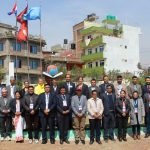
This conference will attract top decision makers from government and private sector to prospective users, academics, vendors, policy makers and representatives of various national and international organizations working in the arena of the Geomatics industry and technology in Africa.
A series of plenary and parallel technical sessions as well as panel discussions is scheduled throughout the three day conference. The official language of the conference will be English.
AfricaGEO Conference and Exhibition builds on the proud tradition of the Conference of Southern African Surveyors (CONSAS), a conference that first started in 1961.